High altitude + closure risk · From Toluca
Nevado de Toluca From Toluca: Is the High-Altitude Trip Worth Planning?
A current-access guide to Nevado de Toluca from Toluca covering the reported closure, altitude, weather, route uncertainty, reopening checks, and lower-altitude alternatives.
Reviewed and updated July 12, 2026. Conditions, fees, access systems, and transport practices can change.
Access Reality Check
The reward, the catch, and the effort
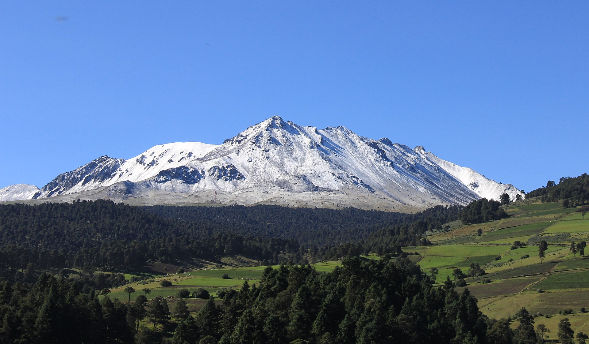
The reward: A dramatic high-altitude volcanic landscape above the Toluca Valley, with a broad caldera and crater lakes when access is officially open.
The catch: The summit area has been reported closed indefinitely since August 2025, and altitude, cold, wind, weather, and changing controls remain serious even after any reopening.
Best practical base: Toluca or Zinacantepec, not Mexico City, when the mountain is the priority
Worth it if…
- Official authorities have clearly confirmed reopening and the exact visitor route you intend to use.
- Your group is prepared for high altitude, cold, wind, and a physically demanding environment.
- You are staying in Toluca or nearby and have a useful lower-altitude fallback.
Think twice if…
- You are relying on an old blog, map pin, or tour listing as proof that the crater is open.
- Anyone in the group has altitude sensitivity, respiratory concerns, poor cold tolerance, or limited mobility.
- Cloud, rain, snow, wind, or low visibility would remove the main reason for going.
The first access question is not how to get there
For Nevado de Toluca, the first question is whether the summit area is officially open at all.
Current reference sources continue to describe the protected area as closed indefinitely following an August 2025 accident. That makes older route articles, cached map directions, tour listings, and social-media posts unreliable evidence of access.
The honest current verdict is simple:
Do not travel toward the crater until an official authority confirms reopening and explains the operating system in effect that day.
This guide remains useful because reopening, when it comes, will not remove the altitude, weather, transport, and group-fit questions.
Why Toluca is the correct planning base
Many travelers search for Nevado de Toluca from Mexico City because that is where they are staying.
Toluca is the more sensible operational base when the mountain is the main purpose. It reduces the road commitment, makes early official checks easier, and protects the day with city, food, cultural, and lower-altitude alternatives.
Useful base areas include:
- Toluca Centro for hotels, transport, and city options
- Zinacantepec for proximity to the western mountain corridor
- Metepec for lodging, restaurants, and a flexible Toluca Valley stay
Mexico City can still support a guided trip after reopening, but it adds another long travel layer before the mountain effort begins.
Old access descriptions may no longer apply
Historic descriptions commonly mention roads, gates, parking areas, shuttles, and walking routes toward the crater.
A closure often changes the eventual reopening system. Authorities may introduce:
- new capacity limits
- authorized shuttles
- revised parking areas
- different walking distances
- timed entry
- weather closures
- restricted zones
- new guide or registration requirements
Do not copy an old itinerary into a newly reopened protected area.
The altitude is not a decorative number
Nevado de Toluca rises to roughly 4,680 meters, while the crater lakes sit around 4,200 meters.
At those elevations, some visitors experience:
- headache
- nausea
- dizziness
- unusual fatigue
- breathlessness
- poor coordination
- rapid chilling
Fitness does not guarantee immunity. A strong sea-level traveler can still feel altitude quickly.
The correct response to worsening symptoms is to descend, not to negotiate with the mountain because the photographs are excellent.
A crater visit is not the same as a summit hike
Travel content often blends several very different outings:
- reaching an authorized upper access area
- walking to a crater viewpoint
- descending toward the lakes
- hiking the crater rim
- attempting Pico del Fraile or another summit route
These have different effort, exposure, skill, and safety requirements.
A visitor who is prepared for a viewpoint is not automatically prepared for a summit route. Any post-reopening guide or operator should state exactly which outing is being sold.
Weather can erase the reward
The mountain can be cold, windy, foggy, wet, icy, or snow-covered. Conditions in Toluca do not reliably describe conditions high on the volcano.
Cloud can remove the crater view. Wind can turn a manageable temperature into an unpleasant one. Rain or ice can change footing and access decisions.
The visual reward depends heavily on visibility, so a poor forecast is not merely an inconvenience. It can remove the central reason for the trip.
Clothing and equipment should match the altitude
After official reopening, a sensible nontechnical visit may still require:
- warm layers
- wind protection
- rain protection
- sun protection
- secure footwear
- water and food
- a charged phone and offline information
- conservative turnaround timing
Summit or winter routes may require technical judgment and equipment well beyond an ordinary tourist visit. The site should never imply that a scenic crater is automatically a casual walk.
Driving does not solve the mountain
A rental car may offer schedule control inside a wider Toluca or central Mexico itinerary.
It does not solve:
- closure status
- authorization
- road restrictions
- shuttle rules
- weather
- altitude
- driver fatigue
- safe descent timing
Because of the current closure uncertainty, this page does not push a manual rental-car CTA. The monetized path is lodging flexibility in Toluca, where the day can still work if the mountain does not.
What should travelers do while it remains closed?
Do not approach a closure hoping that a guard, local driver, or informal route will make an exception.
Instead:
- Keep Nevado de Toluca as a future or conditional plan.
- Stay in Toluca, Zinacantepec, or Metepec only if the wider region interests you.
- Check official reopening announcements close to travel.
- Preserve a lower-altitude alternative.
- Reject operators who describe access more confidently than the authorities do.
A closed protected area is not a puzzle to beat.
The honest fallback
Toluca and Metepec support a worthwhile inland day through museums, food, architecture, markets, and the broader Toluca Valley.
A lower-altitude forest outing can provide mountain scenery and outdoor time without the same crater access and altitude exposure, but current access and weather still need checking.
The fallback is not supposed to imitate Nevado de Toluca. It protects the day when the signature destination is unavailable.
What a responsible reopening plan should answer
Before this guide changes from “conditional” to “go,” the operational picture should be clear:
- Who officially reopened the area?
- Which date did reopening begin?
- Which visitor zones are open?
- How do travelers reach the authorized start point?
- Are private vehicles allowed?
- Are shuttles required?
- What are the capacity and timing rules?
- What weather conditions trigger closure?
- What emergency and rescue provisions exist?
Until those questions have current answers, certainty is marketing—not guidance.
Final decision
Nevado de Toluca still earns a place on this site because access status changes the entire worth-the-trip calculation.
Right now, do not build a crater day around assumptions. Use Toluca as a flexible base, confirm official reopening, respect altitude and weather, and preserve a lower-altitude alternative.
When the mountain reopens, the answer may become yes. Until then, the honest answer is not yet.
Where to stay for this route
Use Toluca as the practical base while summit access remains uncertain
Toluca and Zinacantepec are the logical operational bases for Nevado de Toluca because they keep travelers close to official access updates, mountain transport providers, and lower-altitude alternatives. Mexico City has a larger hotel and tour market, but it adds a substantial transfer before any mountain access begins.
Toluca Centro
Best for broad lodging choice, restaurants, transport connections, and a flexible city itinerary if mountain access is suspended.
Zinacantepec
A practical western Toluca-area base closer to the usual road corridor toward the mountain and useful for checking local conditions.
Metepec
A polished lodging and dining base for travelers who want the Toluca Valley without building the entire stay around a mountain visit that may not operate.
Useful geographic context: The relevant geography runs from Toluca and Zinacantepec toward Raíces and the protected mountain area. Because the summit zone has been reported closed since August 2025, the hotel decision should preserve Toluca, Metepec, and lower-altitude forest alternatives rather than depend on crater access.
Compare Toluca-area stays before planning around the mountain
Use Toluca, Zinacantepec, or Metepec as a flexible base and verify official reopening information before assigning a full day to Nevado de Toluca.
Affiliate link: we may earn a commission at no additional cost to you.
Before you commit the day
What to confirm locally
- Official reopening status from the protected-area authority and State of Mexico sources.
- Which roads, parking areas, shuttles, gates, trails, crater areas, and lakes are currently open.
- Current operating days, entry times, capacity controls, fees, and last permitted descent or exit.
- Mountain weather, wind, visibility, rain, ice, snow, and emergency advisories for the day.
- Whether your transport provider is authorized and what happens if access is suspended after departure.
The honest fallback
Easier alternative: Toluca, Metepec, or a lower-altitude forest day
When summit access remains closed or mountain conditions are poor, the Toluca Valley and lower-altitude forest areas preserve a useful inland day without pretending the crater is available.
Plan the easier Toluca, Metepec, or a lower-altitude forest day option
When the summit remains closed or weather and altitude are poor fits, a Toluca, Metepec, or La Marquesa-area day preserves the trip without pretending the crater is accessible.
Compare flexible Toluca Valley stays →Affiliate link: we may earn a commission at no additional cost to you.
Research notes and sources
We use cautious language because route conditions and visitor systems change. These sources establish the destination context; confirm current operational details directly before traveling.